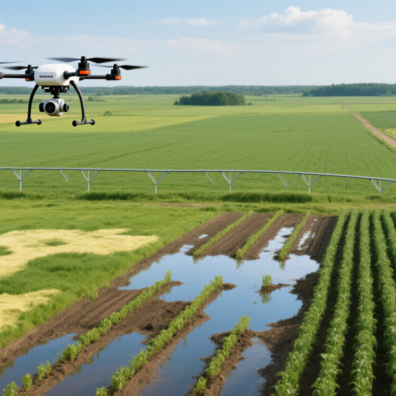
| Crop Scouting Coverage | Approximately 10–40 hectares per hour for many multirotor mapping missions, depending on altitude, image overlap, terrain, and battery changes. | Large fields can be inspected more frequently than by walking every row, helping identify uneven emergence, irrigation problems, weed patches, and crop stress. | Coverage varies significantly with mission design, field shape, wind, and image-processing requirements. |
| Image Detail | Low-altitude RGB, multispectral, or thermal missions can commonly produce imagery with ground sampling distances of about 1–5 cm per pixel. | Detailed imagery can reveal within-field variation that may be missed by satellite imagery or occasional visual inspections. | Image quality depends on flight height, camera sensor, lighting, motion, and processing software. |
| Flight Endurance | Many multirotor agriculture drones operate for roughly 15–40 minutes per battery, while fixed-wing systems may remain airborne for approximately 45–120 minutes. | Short, repeatable missions support regular crop monitoring during key growth stages. | Payload weight, temperature, wind, battery age, and safety reserves reduce usable flight time. |
| Variable-Rate Application | Spraying systems can adjust application according to prescription maps, crop zones, detected stress, or target location. | Inputs can be directed toward affected areas instead of treating an entire field uniformly, potentially improving application efficiency. | A prescription map must be agronomically valid, and local pesticide labels and application rules must be followed. |
| Typical Spray Volume | Many agricultural spraying operations use approximately 10–40 litres per hectare, although the correct rate depends on the product, crop, nozzle, target, and label. | Lower carrier volumes can reduce water transport, refill frequency, and field-entry requirements in suitable applications. | Lower volume does not automatically mean better performance; droplet size, coverage, drift control, and label requirements remain critical. |
| Field Traffic | Flight-based monitoring and application can operate without driving a tractor or sprayer through the crop. | Reduced wheel traffic can help protect standing crops, avoid some soil compaction, and improve access to wet or difficult-to-reach areas. | Drones do not eliminate the need for ground equipment for many planting, harvesting, tillage, and bulk-input operations. |
| Timeliness of Treatment | On-demand flights can be scheduled shortly after scouting identifies a localized problem, subject to weather and regulations. | Faster response may reduce the time between detecting a pest, disease, or nutrient issue and taking corrective action. | Treatment timing must still follow integrated pest-management principles and product restrictions. |
| Water and Terrain Access | Airborne systems can reach slopes, soft soils, narrow plots, terraces, and crops that are difficult for heavy machinery to enter. | Farm operations can continue in locations where ground equipment might cause damage or become stuck. | Battery logistics, refill points, launch areas, and safe separation from people and obstacles are required. |
| Labor Efficiency | Automated flight planning, repeatable routes, and digital mapping reduce some manual scouting and measurement tasks. | Farm staff can spend less time walking large fields and more time validating findings and making management decisions. | Human review remains necessary because imagery can produce false positives and does not replace field verification. |
| Data-Based Decisions | Flight data can be converted into orthomosaics, elevation models, vegetation-index maps, plant counts, and thermal maps. | Historical layers make it easier to compare crop development, identify recurring problem zones, and prioritize field visits. | Consistent flight settings and good data management are needed for meaningful comparisons over time. |
| Weather Limitations | Small drones are generally sensitive to strong wind, rain, poor visibility, and extreme temperatures; spraying performance is also affected by wind and humidity. | When conditions are suitable, drones can provide a flexible alternative to waiting for large machinery or ideal soil traffic conditions. | The aircraft manual, chemical label, aviation rules, and local weather guidance should determine operating limits. |
| Regulatory Requirements | Commercial operations may require aircraft registration, pilot qualifications, operational approvals, maintenance records, and pesticide-application authorization. | Compliance supports safer operations and reduces legal, environmental, and liability risks. | Requirements differ by country, region, aircraft weight, airspace, and whether spraying is performed. |
| Best-Fit Farming Applications | Crop scouting, stand counts, irrigation inspection, weed mapping, disease monitoring, spot spraying, orchard assessment, and drainage analysis. | Drones are most valuable when decisions depend on frequent, location-specific information rather than one uniform treatment for the whole field. | A clear operational goal and measurable return should be defined before purchasing equipment. |